Task 4: Translator
Hi! I’m Irene, this week’s translator. :)
In this task, we are working with: Cartographic projections and treasure hunts, for this reason I will choose five concepts related to this topic, and that in our opinion are the most important.
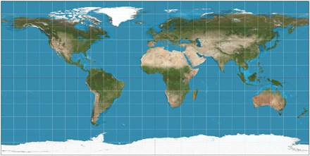
Firstly, the Mercator projection (1) is known as a map projection created by Gerardus Mercator in 1569. In this type, the meridians are drawn parallel to each other in vertical lines; and the parallels of latitude are straight lines whose distance between each other increases with their distance from the Equator.
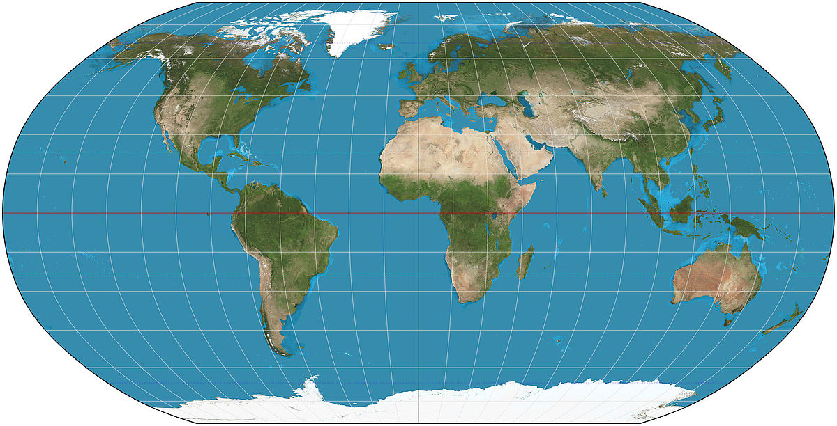
Apart from that, we also find the Robinson projection (2). It is also a map projection, but, in this case, the poles are shown as lines instead of points.The purpose of Robinson is finding a good consensus on the problem of easily showing the entire globe in a flat image besides,making world map ‘’looking right’’, rather than measure precisely.
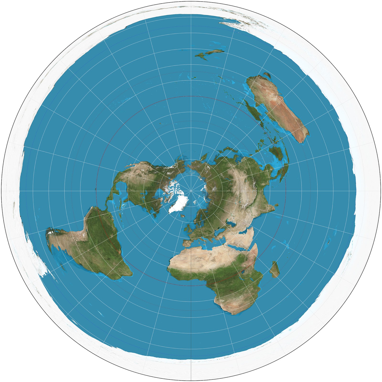
On the other hand, we find the Azimuthal projection (3) which is another type of map projection, but it shows the meridians as straights, with distances which are correctly represented from the pole.
We also find the concept of Treasure hunt (4) important, as it was a crucial point, not only for this task, but also for our presentation. It is a game in which the players are given a series of clues to get to a hidden prize. In this occasion, instead of a prize, the last part was a big question to make students think about the concrete topic of the game.
To finish, we thought the term of distortion (5) needs to be highlighted as well since it was one of the main reasons for developing this activity. It is a change to the original or natural shape of something. In this case, we refer to maps’ distortion in size which may confuse children.
We hope you have learnt more in depth these concepts and that you really enjoyed our presentation about them last wednesday!
Stay tuned!
Comentarios
Publicar un comentario